Geolocate

Sambruson topographic map

Click on the map to display elevation.

About this map

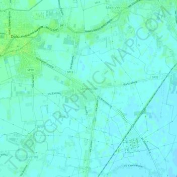
Name: Sambruson topographic map, elevation, terrain.

Location: Sambruson, Dolo, Venezia, Veneto, 30031, Italia (45.39320 12.08005 45.43320 12.12005)

Average elevation: 10 ft

Minimum elevation: -3 ft

Maximum elevation: 30 ft

Gear up for your next adventure:

👟Men's Trail Runners - Lightweight footwear for fast-paced exploration and light hiking
Backpacking Tent - Lightweight and durable tent for multi‑day hikes
😴Insulated Sleeping Pads - Compact and warm pads for high-elevation camping
🪶LED Camping Lantern - Bright lantern for camp lighting
🧼Biodegradable Camping Soap - Eco‑friendly soap for outdoor hygiene

As an Amazon Associate, this site earns from qualifying purchases at no extra cost to you.