Geolocate

Formentera topographic map

Click on the map to display elevation.

About this map

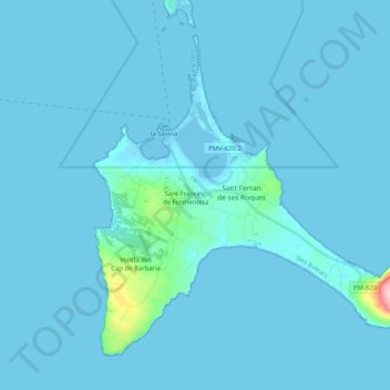
Name: Formentera topographic map, elevation, terrain.

Location: Formentera, Balearic Islands, Spain (38.64045 1.38013 38.77201 1.58475)

Average elevation: 23 ft

Minimum elevation: -13 ft

Maximum elevation: 630 ft

Gear up for your next adventure:

🛌Ultralight Sleeping Bags - Compact down bags for cold nights in the wilderness
📡GPS Antenna Upgrade - Enhance GPS reception in remote terrain
🧭Outdoor Navigation Book - Learn advanced navigation skills
❄️Traction Cleats - Prevent slips on icy trails during winter hikes
🪶LED Camping Lantern - Bright lantern for camp lighting

As an Amazon Associate, this site earns from qualifying purchases at no extra cost to you.