
Thank you for supporting this site ❤️
Make a donation
Make a donation
Gear up for your next adventure:
As an Amazon Associate, this site earns from qualifying purchases at no extra cost to you.
Mortitx topographic map
Click on the map to display elevation.
Thank you for supporting this site ❤️
Make a donation
Make a donation
Gear up for your next adventure:
As an Amazon Associate, this site earns from qualifying purchases at no extra cost to you.
About this map
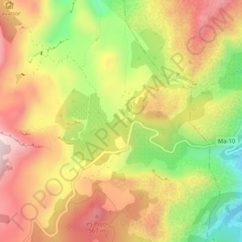
Name: Mortitx topographic map, elevation, terrain.
Location: Mortitx, Escorca, Sierra de Tramontana, Islas Baleares, España (39.85947 2.91344 39.87947 2.93344)
Average elevation: 1,306 ft
Minimum elevation: 505 ft
Maximum elevation: 1,972 ft
Thank you for supporting this site ❤️
Make a donation
Make a donation
Gear up for your next adventure:
As an Amazon Associate, this site earns from qualifying purchases at no extra cost to you.