Geolocate

Brengon topographic map

Click on the map to display elevation.

About this map

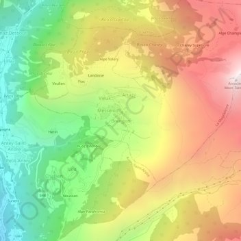
Name: Brengon topographic map, elevation, terrain.

Location: Brengon, La Magdeleine, Aosta Valley, Italy (45.78894 7.59834 45.82894 7.63834)

Average elevation: 5,758 ft

Minimum elevation: 2,871 ft

Maximum elevation: 8,907 ft

Gear up for your next adventure:

🛰️Satellite Messengers - Emergency SOS and two-way messaging for off-grid adventures
👖Convertible Hiking Pants - Versatile zip-off pants for changing altitudes and temperatures
🪑Ultralight Camp Chairs - Portable seating for resting after a long day of mapping
🔊Portable Camp Speaker - Music and alerts at camp
🎒Hydration Pack - Hands‑free water reservoir for long hikes

As an Amazon Associate, this site earns from qualifying purchases at no extra cost to you.