Geolocate

Maé topographic map

Click on the map to display elevation.

About this map

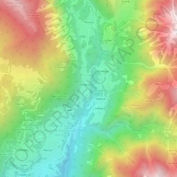
Name: Maé topographic map, elevation, terrain.

Location: Maé, Challand-Saint-Anselme, Aosta Valley, 11022, Italy (45.70460 7.72610 45.74460 7.76610)

Average elevation: 4,646 ft

Minimum elevation: 2,815 ft

Maximum elevation: 7,185 ft

Gear up for your next adventure:

🕶️GPS Smartphone Mount - Secure mount for phone navigation
🔭Stargazing Telescopes - Perfect for camping in low-light pollution areas shown on maps
🛠️Backpacking Tool Kit - Essential toolkit for outdoor repairs
🧭Outdoor Navigation Book - Learn advanced navigation skills
📶Satellite Messenger - Communication device off‑grid

As an Amazon Associate, this site earns from qualifying purchases at no extra cost to you.