Geolocate

Monterroso topographic map

Click on the map to display elevation.

About this map
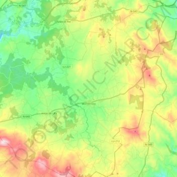
Name: Monterroso topographic map, elevation, terrain.

Location: Monterroso, A Ulloa, Lugo, Galicia, Spain (42.71836 -7.88727 42.89509 -7.71207)

Average elevation: 1,913 ft

Minimum elevation: 1,083 ft

Maximum elevation: 2,920 ft

Other topographic maps

Click on a map to view its topography, its elevation and its terrain.

O Vilar

Spain > Galicia > A Ulloa

Average elevation: 1,486 ft

Gear up for your next adventure:

🎁Geography Themed Gifts - Unique gift ideas for map lovers and geography enthusiasts
👟Trail Running Shoes - Lightweight shoes for trail runners
🏫Relief Map Kits - Hands-on tools for teaching landforms and elevation
🩳Quick‑Dry Hiking Shorts - Comfortable and quick‑dry shorts for summer hiking
🦶Hiking Gaiters - Keep debris and water out of your boots

As an Amazon Associate, this site earns from qualifying purchases at no extra cost to you.