Geolocate

Mezzano topographic map

Click on the map to display elevation.

About this map

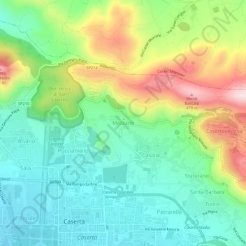
Name: Mezzano topographic map, elevation, terrain.

Location: Mezzano, Caserta, Campania, 81100, Italy (41.07808 14.32529 41.11808 14.36529)

Average elevation: 679 ft

Minimum elevation: 197 ft

Maximum elevation: 1,631 ft

Gear up for your next adventure:

🪶LED Camping Lantern - Bright lantern for camp lighting
🗻Climbing Gear Basics - Essential gear for beginner climbers
🌎3D Topographic Globes - Raised relief globes for a tactile understanding of geography
🌄Hiking Binoculars - Compact binoculars for scenic views and trail spotting
🚗GPS Dash Cams - Record your scenic drives through mountain passes and canyons

As an Amazon Associate, this site earns from qualifying purchases at no extra cost to you.