
红崖子乡 topographic map
Interactive map
Click on the map to display elevation.
About this map
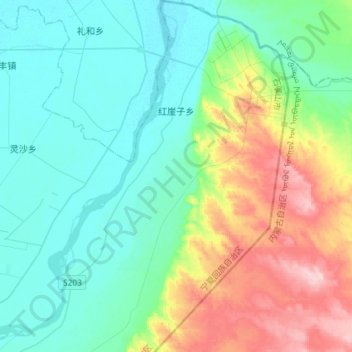
Name: 红崖子乡 topographic map, elevation, terrain.
Location: 红崖子乡, 平罗县, 石嘴山市, 宁夏回族自治区, 中国 (38.86382 106.77252 39.09018 106.96510)
Average elevation: 3,730 ft
Minimum elevation: 3,576 ft
Maximum elevation: 4,167 ft
Other topographic maps
Click on a map to view its topography, its elevation and its terrain.