
陶乐镇 topographic map
Interactive map
Click on the map to display elevation.
About this map
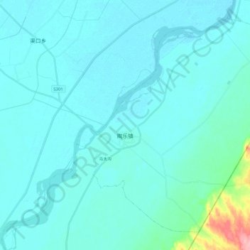
Name: 陶乐镇 topographic map, elevation, terrain.
Location: 陶乐镇, 平罗县, 石嘴山市, 宁夏回族自治区, 中国 (38.74924 106.64855 38.88652 106.85425)
Average elevation: 3,625 ft
Minimum elevation: 3,593 ft
Maximum elevation: 3,947 ft
Other topographic maps
Click on a map to view its topography, its elevation and its terrain.