
Fossil Creek Park topographic map
Interactive map
Click on the map to display elevation.
About this map
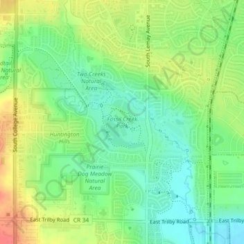
Name: Fossil Creek Park topographic map, elevation, terrain.
Average elevation: 4,957 ft
Minimum elevation: 4,879 ft
Maximum elevation: 5,059 ft
Other topographic maps
Click on a map to view its topography, its elevation and its terrain.
Fort Collins
United States > Colorado > Larimer County > Fort Collins
Fort Collins, Larimer County, Colorado, 80525-2227, United States
Average elevation: 5,312 ft