Geolocate

Winters topographic map

Click on the map to display elevation.

About this map

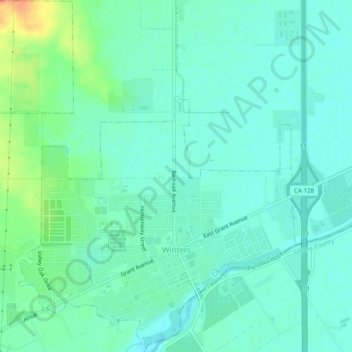
Name: Winters topographic map, elevation, terrain.

Location: Winters, Yolo County, California, United States (38.51424 -122.00060 38.55217 -121.95422)

Average elevation: 141 ft

Minimum elevation: 105 ft

Maximum elevation: 243 ft

Yolo County trails, hiking, mountain biking, running and outdoor activities

Other topographic maps

Click on a map to view its topography, its elevation and its terrain.

Madison

United States > California > Yolo County

Average elevation: 154 ft

Knights Landing

United States > California > Yolo County

Average elevation: 30 ft

Central

United States > California > Yolo County

Average elevation: 3 ft

Knights Landing

United States > California > Yolo County

Average elevation: 30 ft

Glascock Mountain

United States > California > Yolo County

Average elevation: 1,565 ft

Davis

United States > California > Yolo County > Davis > Davis

Davis lies in the Sacramento Valley, the northern portion of the Central Valley, in Northern California, at an elevation of about 52 feet (16 m) above sea level.

Average elevation: 49 ft

Gear up for your next adventure:

🏫Relief Map Kits - Hands-on tools for teaching landforms and elevation
🚁Photography Drones - Capture stunning aerial views of landforms and topography
🧭Compass with Lanyard - Easy‑carry compass for navigation
📡Handheld GPS Device - Reliable handheld GPS for outdoor navigation
🌡️Handheld Weather Meters - Measure wind, temp, and pressure for safe mountain travel

As an Amazon Associate, this site earns from qualifying purchases at no extra cost to you.