Geolocate

Turrell topographic map

Click on the map to display elevation.

About this map

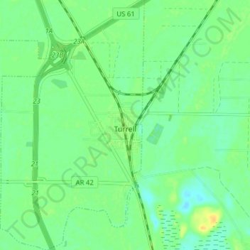
Name: Turrell topographic map, elevation, terrain.

Location: Turrell, Crittenden County, Arkansas, United States (35.35153 -90.28853 35.40308 -90.25197)

Average elevation: 223 ft

Minimum elevation: 194 ft

Maximum elevation: 266 ft

Crittenden County trails, hiking, mountain biking, running and outdoor activities

Other topographic maps

Click on a map to view its topography, its elevation and its terrain.

Julius

United States > Arkansas > Crittenden County

Average elevation: 217 ft

Hulbert

United States > Arkansas > Crittenden County > West Memphis

Average elevation: 213 ft

Proctor

United States > Arkansas > Crittenden County

Average elevation: 207 ft

Gear up for your next adventure:

🔊Portable Camp Speaker - Music and alerts at camp
📖Nature Tracking Books - Learn to track wildlife and terrain
🎁Geography Themed Gifts - Unique gift ideas for map lovers and geography enthusiasts
🗺️Topographic Maps - Detailed topo maps for hiking, exploring and outdoor navigation
🛌Ultralight Sleeping Bags - Compact down bags for cold nights in the wilderness

As an Amazon Associate, this site earns from qualifying purchases at no extra cost to you.