
Thank you for supporting this site ❤️
Make a donation
Make a donation
Gear up for your next adventure:
As an Amazon Associate, this site earns from qualifying purchases at no extra cost to you.
Suur Munamägi topographic map
Click on the map to display elevation.
Thank you for supporting this site ❤️
Make a donation
Make a donation
Gear up for your next adventure:
As an Amazon Associate, this site earns from qualifying purchases at no extra cost to you.
About this map
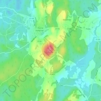
Name: Suur Munamägi topographic map, elevation, terrain.
Location: Suur Munamägi, Rõuge vald, Võru maakond, 65135, Estonia (57.71396 27.05992 57.71406 27.06002)
Average elevation: 850 ft
Minimum elevation: 771 ft
Maximum elevation: 1,027 ft
Thank you for supporting this site ❤️
Make a donation
Make a donation
Gear up for your next adventure:
As an Amazon Associate, this site earns from qualifying purchases at no extra cost to you.
Other topographic maps
Click on a map to view its topography, its elevation and its terrain.