
Make a donation
Gear up for your next adventure:
As an Amazon Associate, this site earns from qualifying purchases at no extra cost to you.
Orscheid topographic map
Click on the map to display elevation.
Make a donation
Gear up for your next adventure:
As an Amazon Associate, this site earns from qualifying purchases at no extra cost to you.
Orscheid
Orscheid liegt in der Mitte der Gemarkung Aegidienberg östlich der Bundesautobahn 3 auf einem in Nord-Süd-Richtung verlaufenden Bergrücken. Die Ortschaft umfasst Höhenlagen zwischen 270 und 310 m ü. NHN. Nach Südosten steigt das Gelände über den an Orscheid angrenzenden Aegidienberger Wald zum Dachsberg an, nach Westen fällt es in das Tal des Retscheider Bachs und nach Nordwesten zum Gieselberg ab. Die nächstgelegenen Orte sind das bis auf 200 m an die geschlossene Ortschaft Orscheids heranreichende Wülscheid im Osten sowie auf der anderen Seite der Autobahn Rottbitze im Südwesten und Retscheid im Westen. Ähnlich wie Wülscheid lässt sich Orscheid in ein Ober- und ein (größeres) Unterdorf gliedern.
Make a donation
Gear up for your next adventure:
As an Amazon Associate, this site earns from qualifying purchases at no extra cost to you.
About this map
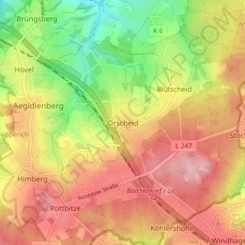
Name: Orscheid topographic map, elevation, terrain.
Average elevation: 899 ft
Minimum elevation: 600 ft
Maximum elevation: 1,135 ft
Make a donation
Gear up for your next adventure:
As an Amazon Associate, this site earns from qualifying purchases at no extra cost to you.