
Thank you for supporting this site ❤️
Make a donation
Make a donation
Gear up for your next adventure:
As an Amazon Associate, this site earns from qualifying purchases at no extra cost to you.
Jam topographic map
Click on the map to display elevation.
Thank you for supporting this site ❤️
Make a donation
Make a donation
Gear up for your next adventure:
As an Amazon Associate, this site earns from qualifying purchases at no extra cost to you.
About this map
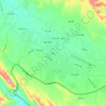
Name: Jam topographic map, elevation, terrain.
Location: Jam, دهستان جم, بخش مرکزی, Jam County, Bushehr Province, Iran (27.78628 52.28636 27.86628 52.36636)
Average elevation: 2,241 ft
Minimum elevation: 1,785 ft
Maximum elevation: 3,396 ft
Thank you for supporting this site ❤️
Make a donation
Make a donation
Gear up for your next adventure:
As an Amazon Associate, this site earns from qualifying purchases at no extra cost to you.