
Binalong Bay topographic map
Click on the map to display elevation.
About this map
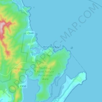
Name: Binalong Bay topographic map, elevation, terrain.
Location: Binalong Bay, Break O'Day, Tasmania, Australia (-41.30480 148.22699 -41.20209 148.33863)
Average elevation: 102 ft
Minimum elevation: -3 ft
Maximum elevation: 1,017 ft
Other topographic maps
Click on a map to view its topography, its elevation and its terrain.