
Balakhna topographic map
Interactive map
Click on the map to display elevation.
About this map
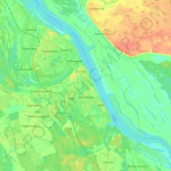
Name: Balakhna topographic map, elevation, terrain.
Average elevation: 249 ft
Minimum elevation: 203 ft
Maximum elevation: 335 ft
Other topographic maps
Click on a map to view its topography, its elevation and its terrain.
Balakhna
Russia > Nizhny Novgorod Oblast > Balakhninsky District > Balakhna
Balakhna, Balakhninsky District, Nizhny Novgorod Oblast, Volga Federal District, 606406, Russia
Average elevation: 246 ft