
Make a donation
Gear up for your next adventure:
As an Amazon Associate, this site earns from qualifying purchases at no extra cost to you.
Orentano topographic map
Click on the map to display elevation.
Make a donation
Gear up for your next adventure:
As an Amazon Associate, this site earns from qualifying purchases at no extra cost to you.
Orentano
L'abitato si trova ai margini occidentali di un vasto territorio di 35–40 m di altitudine media s.l.m. che in origine costituiva un'isola circondata dal mare.
Make a donation
Gear up for your next adventure:
As an Amazon Associate, this site earns from qualifying purchases at no extra cost to you.
About this map
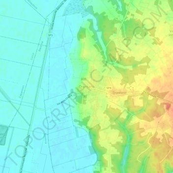
Name: Orentano topographic map, elevation, terrain.
Location: Orentano, Castelfranco di Sotto, Pisa, Toscana, 56022, Italia (43.75965 10.63839 43.79965 10.67839)
Average elevation: 56 ft
Minimum elevation: 3 ft
Maximum elevation: 148 ft
Make a donation
Gear up for your next adventure:
As an Amazon Associate, this site earns from qualifying purchases at no extra cost to you.