Geolocate

Hualatan topographic map

Click on the map to display elevation.

About this map

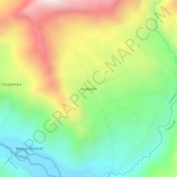
Name: Hualatan topographic map, elevation, terrain.

Location: Hualatan, Chontalí, Jaén, Cajamarca, Perú (-5.71902 -79.06464 -5.67902 -79.02464)

Average elevation: 5,256 ft

Minimum elevation: 3,894 ft

Maximum elevation: 7,251 ft

Gear up for your next adventure:

🩳Quick‑Dry Hiking Shorts - Comfortable and quick‑dry shorts for summer hiking
🛠️Outdoor Gear Repair Kit - Essential tools to fix gear on the trail
🔥Plasma Lighters - Windproof lighters that work in any weather condition
☀️Outdoor Sunscreen - High protection sunscreen for outdoor activities
🧼Biodegradable Camping Soap - Eco‑friendly soap for outdoor hygiene

As an Amazon Associate, this site earns from qualifying purchases at no extra cost to you.