
Thank you for supporting this site ❤️
Make a donation
Make a donation
Gear up for your next adventure:
As an Amazon Associate, this site earns from qualifying purchases at no extra cost to you.
Guita topographic map
Click on the map to display elevation.
Thank you for supporting this site ❤️
Make a donation
Make a donation
Gear up for your next adventure:
As an Amazon Associate, this site earns from qualifying purchases at no extra cost to you.
About this map
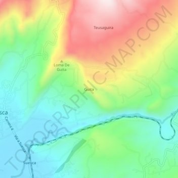
Name: Guita topographic map, elevation, terrain.
Location: Guita, Suesca, Almeidas, Cundinamarca, Región Andina, Colombia (5.08852 -73.79859 5.12852 -73.75859)
Average elevation: 9,052 ft
Minimum elevation: 8,396 ft
Maximum elevation: 10,141 ft
Thank you for supporting this site ❤️
Make a donation
Make a donation
Gear up for your next adventure:
As an Amazon Associate, this site earns from qualifying purchases at no extra cost to you.