
Thank you for supporting this site ❤️
Make a donation
Make a donation
Gear up for your next adventure:
As an Amazon Associate, this site earns from qualifying purchases at no extra cost to you.
V topographic map
Click on the map to display elevation.
Thank you for supporting this site ❤️
Make a donation
Make a donation
Gear up for your next adventure:
As an Amazon Associate, this site earns from qualifying purchases at no extra cost to you.
About this map
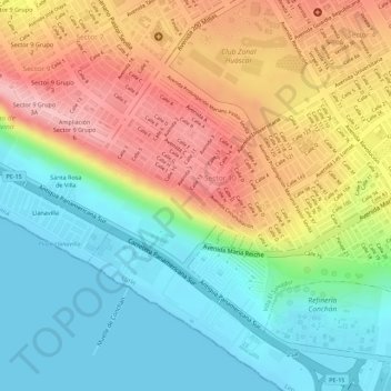
Name: V topographic map, elevation, terrain.
Location: V, Sector 10 Grupo 3A, Villa El Salvador, Lima, Peru (-12.24352 -76.93270 -12.24271 -76.93171)
Average elevation: 236 ft
Minimum elevation: -3 ft
Maximum elevation: 528 ft
Thank you for supporting this site ❤️
Make a donation
Make a donation
Gear up for your next adventure:
As an Amazon Associate, this site earns from qualifying purchases at no extra cost to you.