
Thank you for supporting this site ❤️
Make a donation
Make a donation
Gear up for your next adventure:
As an Amazon Associate, this site earns from qualifying purchases at no extra cost to you.
Rabí topographic map
Click on the map to display elevation.
Thank you for supporting this site ❤️
Make a donation
Make a donation
Gear up for your next adventure:
As an Amazon Associate, this site earns from qualifying purchases at no extra cost to you.
About this map
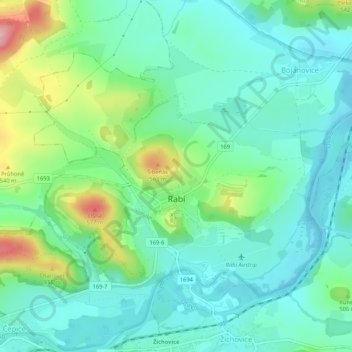
Name: Rabí topographic map, elevation, terrain.
Location: Rabí, okres Klatovy, Plzeňský kraj, Southwest, Czechia (49.27102 13.59743 49.29524 13.65030)
Average elevation: 1,549 ft
Minimum elevation: 1,404 ft
Maximum elevation: 1,952 ft
Thank you for supporting this site ❤️
Make a donation
Make a donation
Gear up for your next adventure:
As an Amazon Associate, this site earns from qualifying purchases at no extra cost to you.