
Make a donation
Gear up for your next adventure:
As an Amazon Associate, this site earns from qualifying purchases at no extra cost to you.
Langenscheid topographic map
Click on the map to display elevation.
Make a donation
Gear up for your next adventure:
As an Amazon Associate, this site earns from qualifying purchases at no extra cost to you.
Langenscheid
Langenscheid wurde erstmals im Jahre 1298 als Langscheyt urkundlich erwähnt. Das Dorf auf der „langen Scheyde“ hat seinen Namen von dem langgestreckten Höhenrücken, der als Wasserscheide den Daubach und den Schwarbach als Nebenbäche der Lahn trennt. Langenscheid gehörte zur Grafschaft Holzappel, ab 1806 war der Ort Teil des Amtes Diez im Herzogtum Nassau, das 1866 von Preußen annektiert wurde. Seit 1946 ist der Ort Teil des Landes Rheinland-Pfalz.
Make a donation
Gear up for your next adventure:
As an Amazon Associate, this site earns from qualifying purchases at no extra cost to you.
About this map
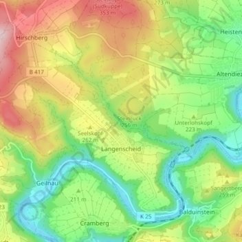
Name: Langenscheid topographic map, elevation, terrain.
Average elevation: 738 ft
Minimum elevation: 318 ft
Maximum elevation: 1,339 ft
Make a donation
Gear up for your next adventure:
As an Amazon Associate, this site earns from qualifying purchases at no extra cost to you.