
Thank you for supporting this site ❤️
Make a donation
Make a donation
Gear up for your next adventure:
As an Amazon Associate, this site earns from qualifying purchases at no extra cost to you.
Shenoua topographic map
Click on the map to display elevation.
Thank you for supporting this site ❤️
Make a donation
Make a donation
Gear up for your next adventure:
As an Amazon Associate, this site earns from qualifying purchases at no extra cost to you.
About this map
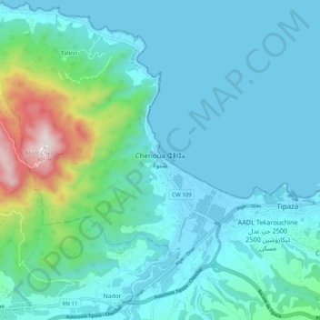
Name: Shenoua topographic map, elevation, terrain.
Location: Shenoua, Tipaza, Tipaza District, Tipaza, 42038, Algeria (36.56333 2.36849 36.64333 2.44849)
Average elevation: 446 ft
Minimum elevation: -7 ft
Maximum elevation: 2,910 ft
Thank you for supporting this site ❤️
Make a donation
Make a donation
Gear up for your next adventure:
As an Amazon Associate, this site earns from qualifying purchases at no extra cost to you.