
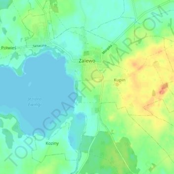
Saalfeld topographic map
Interactive map
Click on the map to display elevation.
About this map
Name: Saalfeld topographic map, elevation, terrain.
Average elevation: 351 ft
Minimum elevation: 312 ft
Maximum elevation: 433 ft
Unter Hochmeister Winrich von Kniprode trat eine Blütezeit von Handel und Gewerbe ein, die 1395 ihren Höhepunkt erreichte und bis zum Krieg mit Polen anhielt. In der Stadt, die damals rund 700 Einwohner hatte, gab es 20 Fleischbänke, 20 Schuhbänke und 16 Brotbänke.
Other topographic maps
Click on a map to view its topography, its elevation and its terrain.
Michelau
Polen > Woiwodschaft Ermland-Masuren > powiat iławski
Michelau, Gemeinde Rosenberg in Westpreußen, powiat iławski, Woiwodschaft Ermland-Masuren, Polen
Average elevation: 354 ft