
Thank you for supporting this site ❤️
Make a donation
Make a donation
Gear up for your next adventure:
As an Amazon Associate, this site earns from qualifying purchases at no extra cost to you.
Ileje topographic map
Click on the map to display elevation.
Thank you for supporting this site ❤️
Make a donation
Make a donation
Gear up for your next adventure:
As an Amazon Associate, this site earns from qualifying purchases at no extra cost to you.
About this map
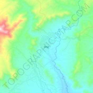
Name: Ileje topographic map, elevation, terrain.
Location: Ileje, Mbeya, Southern Highlands Zone, Tanzania (-9.45152 33.14549 -9.37152 33.22549)
Average elevation: 4,747 ft
Minimum elevation: 4,203 ft
Maximum elevation: 6,611 ft
Thank you for supporting this site ❤️
Make a donation
Make a donation
Gear up for your next adventure:
As an Amazon Associate, this site earns from qualifying purchases at no extra cost to you.