
Thank you for supporting this site ❤️
Make a donation
Make a donation
Gear up for your next adventure:
As an Amazon Associate, this site earns from qualifying purchases at no extra cost to you.
Krün topographic map
Click on the map to display elevation.
Thank you for supporting this site ❤️
Make a donation
Make a donation
Gear up for your next adventure:
As an Amazon Associate, this site earns from qualifying purchases at no extra cost to you.
About this map
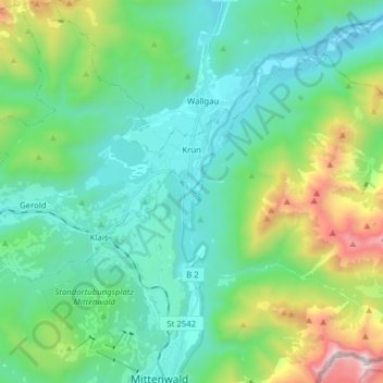
Name: Krün topographic map, elevation, terrain.
Location: Krün, Landkreis Garmisch-Partenkirchen, Baviera, Alemanha (47.44180 11.15763 47.54718 11.29596)
Average elevation: 3,930 ft
Minimum elevation: 2,684 ft
Maximum elevation: 8,054 ft
Thank you for supporting this site ❤️
Make a donation
Make a donation
Gear up for your next adventure:
As an Amazon Associate, this site earns from qualifying purchases at no extra cost to you.