
Thank you for supporting this site ❤️
Make a donation
Make a donation
Gear up for your next adventure:
As an Amazon Associate, this site earns from qualifying purchases at no extra cost to you.
Warredal topographic map
Click on the map to display elevation.
Thank you for supporting this site ❤️
Make a donation
Make a donation
Gear up for your next adventure:
As an Amazon Associate, this site earns from qualifying purchases at no extra cost to you.
About this map
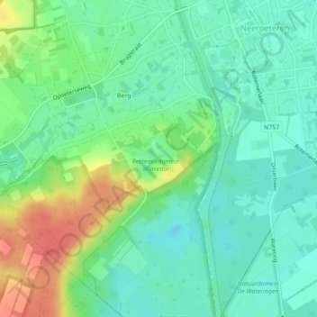
Name: Warredal topographic map, elevation, terrain.
Location: Warredal, Berg, Neeroeteren, Maaseik, Limburg, 3680, België (51.07462 5.68504 51.08030 5.69568)
Average elevation: 151 ft
Minimum elevation: 89 ft
Maximum elevation: 272 ft
Thank you for supporting this site ❤️
Make a donation
Make a donation
Gear up for your next adventure:
As an Amazon Associate, this site earns from qualifying purchases at no extra cost to you.