
Thank you for supporting this site ❤️
Make a donation
Make a donation
Gear up for your next adventure:
As an Amazon Associate, this site earns from qualifying purchases at no extra cost to you.
Alberobello topographic map
Click on the map to display elevation.
Thank you for supporting this site ❤️
Make a donation
Make a donation
Gear up for your next adventure:
As an Amazon Associate, this site earns from qualifying purchases at no extra cost to you.
About this map
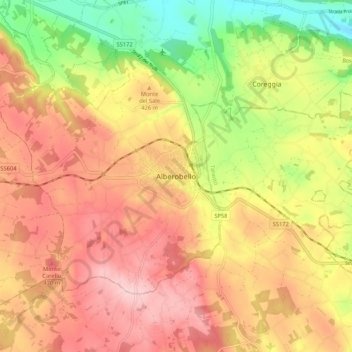
Name: Alberobello topographic map, elevation, terrain.
Location: Alberobello, Bari, Puglia, 70011, Italia (40.74412 17.19770 40.82412 17.27770)
Average elevation: 1,348 ft
Minimum elevation: 955 ft
Maximum elevation: 1,647 ft
Thank you for supporting this site ❤️
Make a donation
Make a donation
Gear up for your next adventure:
As an Amazon Associate, this site earns from qualifying purchases at no extra cost to you.