Geolocate

Admiral topographic map

Click on the map to display elevation.

About this map

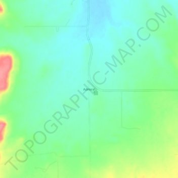
Name: Admiral topographic map, elevation, terrain.

Location: Admiral, Callahan County, Texas, United States (32.27652 -99.31785 32.31652 -99.27785)

Average elevation: 1,690 ft

Minimum elevation: 1,611 ft

Maximum elevation: 1,873 ft

Callahan County trails, hiking, mountain biking, running and outdoor activities

Other topographic maps

Click on a map to view its topography, its elevation and its terrain.

Putnam

United States > Texas > Callahan County

Average elevation: 1,631 ft

Clyde

United States > Texas > Callahan County

Average elevation: 2,005 ft

Clyde

United States > Texas > Callahan County

Average elevation: 2,001 ft

Putnam

United States > Texas > Callahan County

Average elevation: 1,631 ft

Baird

United States > Texas > Callahan County

Average elevation: 1,762 ft

Clyde

United States > Texas > Callahan County

Average elevation: 2,001 ft

Clyde

United States > Texas > Callahan County

Average elevation: 2,001 ft

Clyde

United States > Texas > Callahan County

Average elevation: 2,001 ft

Clyde

United States > Texas > Callahan County

Average elevation: 2,001 ft

Gear up for your next adventure:

🧷Carabiner Set - Durable clips for gear attachment
☀️Outdoor Sunscreen - High protection sunscreen for outdoor activities
🖼️Topo Map Wall Art - Decorative topographic prints of famous peaks and regions
🛠️Backpacking Tool Kit - Essential toolkit for outdoor repairs
🔋Solar Power Banks - Keep your GPS and phone charged in remote wilderness areas

As an Amazon Associate, this site earns from qualifying purchases at no extra cost to you.