
Thank you for supporting this site ❤️
Make a donation
Make a donation
Gear up for your next adventure:
As an Amazon Associate, this site earns from qualifying purchases at no extra cost to you.
Køstrup topographic map
Click on the map to display elevation.
Thank you for supporting this site ❤️
Make a donation
Make a donation
Gear up for your next adventure:
As an Amazon Associate, this site earns from qualifying purchases at no extra cost to you.
About this map
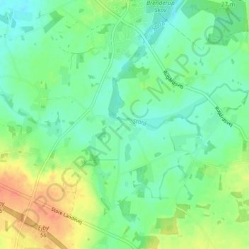
Name: Køstrup topographic map, elevation, terrain.
Location: Køstrup, Middelfart Municipality, 5464, Denmark (55.44844 9.95649 55.48844 9.99649)
Average elevation: 62 ft
Minimum elevation: 13 ft
Maximum elevation: 154 ft
Thank you for supporting this site ❤️
Make a donation
Make a donation
Gear up for your next adventure:
As an Amazon Associate, this site earns from qualifying purchases at no extra cost to you.