
Thank you for supporting this site ❤️
Make a donation
Make a donation
Gear up for your next adventure:
As an Amazon Associate, this site earns from qualifying purchases at no extra cost to you.
Runcorn topographic map
Click on the map to display elevation.
Thank you for supporting this site ❤️
Make a donation
Make a donation
Gear up for your next adventure:
As an Amazon Associate, this site earns from qualifying purchases at no extra cost to you.
About this map
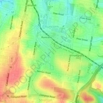
Name: Runcorn topographic map, elevation, terrain.
Location: Runcorn, Brisbane City, Queensland, 4113, Australia (-27.61363 153.06200 -27.58222 153.09606)
Average elevation: 213 ft
Minimum elevation: 118 ft
Maximum elevation: 312 ft
Thank you for supporting this site ❤️
Make a donation
Make a donation
Gear up for your next adventure:
As an Amazon Associate, this site earns from qualifying purchases at no extra cost to you.