Geolocate

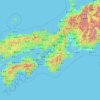
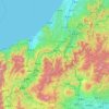
Niigata topographic map

Click on the map to display elevation.

Niigata

Niigata City's low elevation and abundant water have made flood control and land reclamation important issues for the area throughout its history.

Wikipedia (CC-BY-SA 3.0)

About this map

Name: Niigata topographic map, elevation, terrain.

Location: Niigata, Niigata Prefecture, Chubu Region, Japan (37.67897 138.55820 38.23612 139.26681)

Average elevation: 82 ft

Minimum elevation: -26 ft

Maximum elevation: 3,120 ft

Other topographic maps

Click on a map to view its topography, its elevation and its terrain.

300M

Japan > Nagasaki

Average elevation: 722 ft

Osaka Prefecture

Japan

Average elevation: 617 ft

Takeda Castle

Japan > Asago

Average elevation: 571 ft

Akaishi Mountains

Japan > Oshika

Average elevation: 8,501 ft

Iwo to

Japan > Tokyo > Ogasawara

Average elevation: 0 ft

葭町

Japan > Matsumoto

Average elevation: 2,021 ft

Nishikigaoka-chuo Park

Japan > Sendai

Average elevation: 646 ft

Nakauonuma County

Japan

Average elevation: 1,985 ft

Mount Yatsugatake viewpoint

Japan > Suwa County > Fujimi

Average elevation: 5,715 ft

Gear up for your next adventure:

📚Navigation Handbooks - Master the art of reading topographic maps and using a compass
🪶Wildlife Field Guides - Learn animal tracking and species ID
🪵Folding Camp Saw - Compact saw for wood and campsite work
🧭Pro Hiking Compasses - High-accuracy liquid-filled compasses for topographic orientation
🎒Outdoor Daypacks - Lightweight backpacks designed for carrying maps and essential gear

As an Amazon Associate, this site earns from qualifying purchases at no extra cost to you.