
Thank you for supporting this site ❤️
Make a donation
Make a donation
Gear up for your next adventure:
As an Amazon Associate, this site earns from qualifying purchases at no extra cost to you.
Sora topographic map
Click on the map to display elevation.
Thank you for supporting this site ❤️
Make a donation
Make a donation
Gear up for your next adventure:
As an Amazon Associate, this site earns from qualifying purchases at no extra cost to you.
About this map
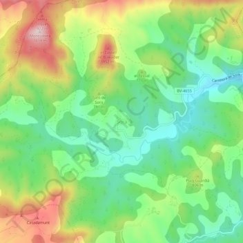
Name: Sora topographic map, elevation, terrain.
Location: Sora, Osona, Barcelona, Catalonia, 08588, Spain (42.09194 2.14105 42.13194 2.18105)
Average elevation: 2,461 ft
Minimum elevation: 1,959 ft
Maximum elevation: 3,271 ft
Thank you for supporting this site ❤️
Make a donation
Make a donation
Gear up for your next adventure:
As an Amazon Associate, this site earns from qualifying purchases at no extra cost to you.