Geolocate

Mohawk topographic map

Click on the map to display elevation.

About this map

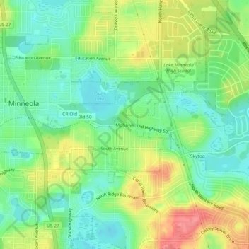
Name: Mohawk topographic map, elevation, terrain.

Location: Mohawk, Minneola, Lake County, Florida, 32711, United States (28.55222 -81.74980 28.59222 -81.70980)

Average elevation: 157 ft

Minimum elevation: 59 ft

Maximum elevation: 308 ft

Lake County trails, hiking, mountain biking, running and outdoor activities

Gear up for your next adventure:

🔋Solar Power Banks - Keep your GPS and phone charged in remote wilderness areas
GPS Sports Watch - GPS watch for running, hiking and training
🧣Merino Neck Gaiters - Multi-functional headwear for wind and sun protection
🪶Multi‑Purpose Knife - Useful blade for camp and trail
📦Dry Bags Set - Waterproof storage for electronics and clothes

As an Amazon Associate, this site earns from qualifying purchases at no extra cost to you.