
Thank you for supporting this site ❤️
Make a donation
Make a donation
Gear up for your next adventure:
As an Amazon Associate, this site earns from qualifying purchases at no extra cost to you.
Taghzout topographic map
Click on the map to display elevation.
Thank you for supporting this site ❤️
Make a donation
Make a donation
Gear up for your next adventure:
As an Amazon Associate, this site earns from qualifying purchases at no extra cost to you.
About this map
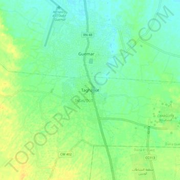
Name: Taghzout topographic map, elevation, terrain.
Location: Taghzout, Guemar District, El Oued, 39002, Algeria (33.43548 6.75985 33.51548 6.83985)
Average elevation: 220 ft
Minimum elevation: 190 ft
Maximum elevation: 259 ft
Thank you for supporting this site ❤️
Make a donation
Make a donation
Gear up for your next adventure:
As an Amazon Associate, this site earns from qualifying purchases at no extra cost to you.