
Thank you for supporting this site ❤️
Make a donation
Make a donation
Gear up for your next adventure:
As an Amazon Associate, this site earns from qualifying purchases at no extra cost to you.
Salina topographic map
Click on the map to display elevation.
Thank you for supporting this site ❤️
Make a donation
Make a donation
Gear up for your next adventure:
As an Amazon Associate, this site earns from qualifying purchases at no extra cost to you.
About this map
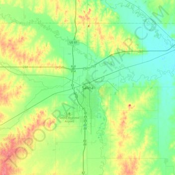
Name: Salina topographic map, elevation, terrain.
Location: Salina, Saline County, Kansas, 67401, États-Unis d'Amérique (38.68028 -97.77142 39.00028 -97.45142)
Average elevation: 1,280 ft
Minimum elevation: 1,168 ft
Maximum elevation: 1,532 ft
Thank you for supporting this site ❤️
Make a donation
Make a donation
Gear up for your next adventure:
As an Amazon Associate, this site earns from qualifying purchases at no extra cost to you.