
Thank you for supporting this site ❤️
Make a donation
Make a donation
Gear up for your next adventure:
As an Amazon Associate, this site earns from qualifying purchases at no extra cost to you.
Geles topographic map
Click on the map to display elevation.
Thank you for supporting this site ❤️
Make a donation
Make a donation
Gear up for your next adventure:
As an Amazon Associate, this site earns from qualifying purchases at no extra cost to you.
About this map
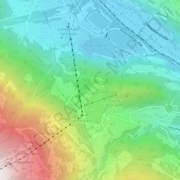
Name: Geles topographic map, elevation, terrain.
Location: Geles, Vandans, Bezirk Bludenz, Vorarlberg, 6773, Autriche (47.06949 9.86360 47.08949 9.88360)
Average elevation: 3,097 ft
Minimum elevation: 2,070 ft
Maximum elevation: 5,433 ft
Thank you for supporting this site ❤️
Make a donation
Make a donation
Gear up for your next adventure:
As an Amazon Associate, this site earns from qualifying purchases at no extra cost to you.
Other topographic maps
Click on a map to view its topography, its elevation and its terrain.