Geolocate

Vienna topographic map

Click on the map to display elevation.

About this map

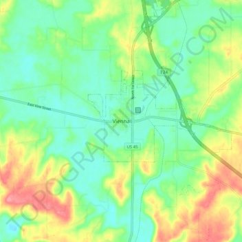
Name: Vienna topographic map, elevation, terrain.

Location: Vienna, Johnson County, Illinois, 62995, United States (37.37533 -88.93784 37.45533 -88.85784)

Average elevation: 433 ft

Minimum elevation: 328 ft

Maximum elevation: 617 ft

Johnson County trails, hiking, mountain biking, running and outdoor activities

Gear up for your next adventure:

🧷Carabiner Set - Durable clips for gear attachment
🔦Compact Flashlight - Reliable flashlight for emergencies
🦶Hiking Gaiters - Keep debris and water out of your boots
🪶Trail Camera - Capture wildlife on your hikes
🥘Titanium Cookware - Durable, featherlight pots and pans for backpacking

As an Amazon Associate, this site earns from qualifying purchases at no extra cost to you.