Geolocate

Hochheim topographic map

Click on the map to display elevation.

About this map

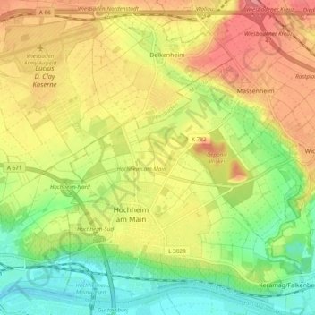
Name: Hochheim topographic map, elevation, terrain.

Location: Hochheim, Main-Taunus-Kreis, Hesse, 65239, Germany (49.99706 8.33019 50.05813 8.41276)

Average elevation: 404 ft

Minimum elevation: 266 ft

Maximum elevation: 548 ft

Gear up for your next adventure:

🪶Survival Guide Book - Expert advice for emergency preparedness
🛡️Insect Repellent - Protection against bugs during outdoor activities
🛠️Outdoor Gear Repair Kit - Essential tools to fix gear on the trail
🩳Quick‑Dry Hiking Shorts - Comfortable and quick‑dry shorts for summer hiking
📡Handheld GPS Device - Reliable handheld GPS for outdoor navigation

As an Amazon Associate, this site earns from qualifying purchases at no extra cost to you.