
Thank you for supporting this site ❤️
Make a donation
Make a donation
Gear up for your next adventure:
As an Amazon Associate, this site earns from qualifying purchases at no extra cost to you.
Panchnadi topographic map
Click on the map to display elevation.
Thank you for supporting this site ❤️
Make a donation
Make a donation
Gear up for your next adventure:
As an Amazon Associate, this site earns from qualifying purchases at no extra cost to you.
About this map
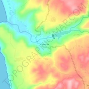
Name: Panchnadi topographic map, elevation, terrain.
Location: Panchnadi, Dapoli Taluka, Ratnagiri, Maharashtra, India (17.61407 73.13268 17.65407 73.17268)
Average elevation: 299 ft
Minimum elevation: -3 ft
Maximum elevation: 610 ft
Thank you for supporting this site ❤️
Make a donation
Make a donation
Gear up for your next adventure:
As an Amazon Associate, this site earns from qualifying purchases at no extra cost to you.