
Thank you for supporting this site ❤️
Make a donation
Make a donation
Gear up for your next adventure:
As an Amazon Associate, this site earns from qualifying purchases at no extra cost to you.
Mananga River topographic map
Click on the map to display elevation.
Thank you for supporting this site ❤️
Make a donation
Make a donation
Gear up for your next adventure:
As an Amazon Associate, this site earns from qualifying purchases at no extra cost to you.
About this map
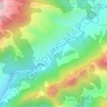
Name: Mananga River topographic map, elevation, terrain.
Location: Mananga River, Buot, Cebu City, Central Visayas, Philippines (10.33981 123.79987 10.36408 123.82582)
Average elevation: 1,152 ft
Minimum elevation: 407 ft
Maximum elevation: 2,382 ft
Thank you for supporting this site ❤️
Make a donation
Make a donation
Gear up for your next adventure:
As an Amazon Associate, this site earns from qualifying purchases at no extra cost to you.