
Thank you for supporting this site ❤️
Make a donation
Make a donation
Gear up for your next adventure:
As an Amazon Associate, this site earns from qualifying purchases at no extra cost to you.
L'Arquera topographic map
Click on the map to display elevation.
Thank you for supporting this site ❤️
Make a donation
Make a donation
Gear up for your next adventure:
As an Amazon Associate, this site earns from qualifying purchases at no extra cost to you.
About this map
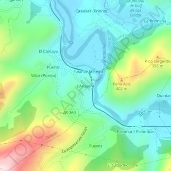
Name: L'Arquera topographic map, elevation, terrain.
Location: L'Arquera, Oviedo, Asturias, 33140, Spain (43.31552 -5.92629 43.31732 -5.92465)
Average elevation: 735 ft
Minimum elevation: 312 ft
Maximum elevation: 1,795 ft
Thank you for supporting this site ❤️
Make a donation
Make a donation
Gear up for your next adventure:
As an Amazon Associate, this site earns from qualifying purchases at no extra cost to you.