
Thank you for supporting this site ❤️
Make a donation
Make a donation
Gear up for your next adventure:
As an Amazon Associate, this site earns from qualifying purchases at no extra cost to you.
Tegoia topographic map
Click on the map to display elevation.
Thank you for supporting this site ❤️
Make a donation
Make a donation
Gear up for your next adventure:
As an Amazon Associate, this site earns from qualifying purchases at no extra cost to you.
About this map
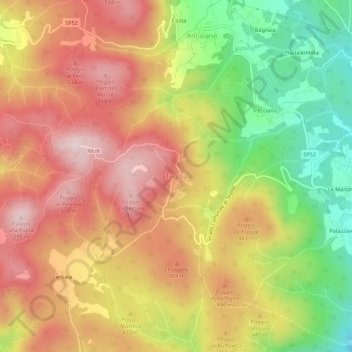
Name: Tegoia topographic map, elevation, terrain.
Location: Tegoia, Sovicille, Siena, Toscana, 53018, Italia (43.25761 11.17807 43.29761 11.21807)
Average elevation: 1,375 ft
Minimum elevation: 659 ft
Maximum elevation: 1,955 ft
Thank you for supporting this site ❤️
Make a donation
Make a donation
Gear up for your next adventure:
As an Amazon Associate, this site earns from qualifying purchases at no extra cost to you.