
Thank you for supporting this site ❤️
Make a donation
Make a donation
Gear up for your next adventure:
As an Amazon Associate, this site earns from qualifying purchases at no extra cost to you.
Eichenzell topographic map
Click on the map to display elevation.
Thank you for supporting this site ❤️
Make a donation
Make a donation
Gear up for your next adventure:
As an Amazon Associate, this site earns from qualifying purchases at no extra cost to you.
About this map
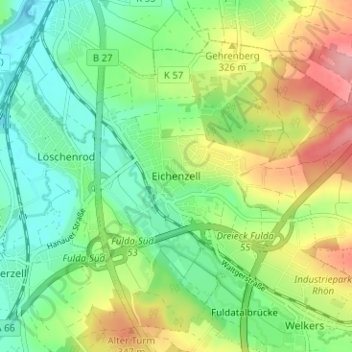
Name: Eichenzell topographic map, elevation, terrain.
Location: Eichenzell, Landkreis Fulda, Hessen, 36124, Deutschland (50.47577 9.67933 50.51577 9.71933)
Average elevation: 991 ft
Minimum elevation: 840 ft
Maximum elevation: 1,243 ft
Thank you for supporting this site ❤️
Make a donation
Make a donation
Gear up for your next adventure:
As an Amazon Associate, this site earns from qualifying purchases at no extra cost to you.