Geolocate

Duffus topographic map

Click on the map to display elevation.

About this map

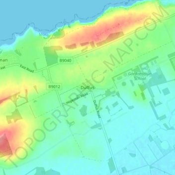
Name: Duffus topographic map, elevation, terrain.

Location: Duffus, Moray, Scotland, IV30 5QL, United Kingdom (57.68098 -3.41456 57.72098 -3.37456)

Average elevation: 69 ft

Minimum elevation: 0 ft

Maximum elevation: 253 ft

Gear up for your next adventure:

🔭Stargazing Telescopes - Perfect for camping in low-light pollution areas shown on maps
📶Satellite Messenger - Communication device off‑grid
🚁Photography Drones - Capture stunning aerial views of landforms and topography
🧢Outdoor Hiking Hat - Sun protection hat for outdoor explorers
🛰️Satellite Messengers - Emergency SOS and two-way messaging for off-grid adventures

As an Amazon Associate, this site earns from qualifying purchases at no extra cost to you.