Geolocate

Mina topographic map

Click on the map to display elevation.

About this map

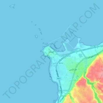
Name: Mina topographic map, elevation, terrain.

Location: Mina, Tripoli District, North Governorate, 1301, Lebanon (34.41111 35.77458 34.49111 35.85458)

Average elevation: 33 ft

Minimum elevation: -10 ft

Maximum elevation: 348 ft

Gear up for your next adventure:

🧭Compass with Lanyard - Easy‑carry compass for navigation
📚USA Hiking Guide Books - Top trail guides and map books
📱Solar Portable Charger - Solar power bank for charging devices off‑grid
🛰️Handheld GPS Units - Professional satellite navigators for precise backcountry mapping
🩹Survival Bandages - High‑quality bandages for emergencies

As an Amazon Associate, this site earns from qualifying purchases at no extra cost to you.