
Rio Canudos topographic map
Click on the map to display elevation.
About this map
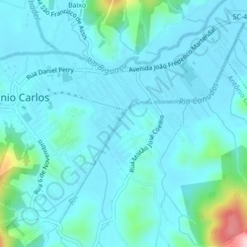
Name: Rio Canudos topographic map, elevation, terrain.
Average elevation: 121 ft
Minimum elevation: 33 ft
Maximum elevation: 699 ft
Other topographic maps
Click on a map to view its topography, its elevation and its terrain.
Reserva Particular do Patrimônio Natural Caraguatá
Brasil > Santa Catarina > Antônio Carlos
Average elevation: 1,877 ft