Geolocate

Brischko topographic map

Click on the map to display elevation.

About this map

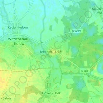
Name: Brischko topographic map, elevation, terrain.

Location: Brischko, Wittichenau, Bautzen, Sachsen, 02997, Deutschland (51.36107 14.24440 51.40107 14.28440)

Average elevation: 420 ft

Minimum elevation: 390 ft

Maximum elevation: 459 ft

Other topographic maps

Click on a map to view its topography, its elevation and its terrain.

02997

Deutschland > Sachsen > Bautzen > Wittichenau

Average elevation: 433 ft

Gear up for your next adventure:

🛰️Handheld GPS Units - Professional satellite navigators for precise backcountry mapping
🧭GPS Watch Accessories - Bands and chargers for GPS watches
🔪Outdoor Multitools - Essential survival tools for gear repair and field use
🎒Trekking Poles - Sturdy poles for balance and stability on rough terrain
Solar GPS Watches - Advanced multisport watches with built-in topographic maps

As an Amazon Associate, this site earns from qualifying purchases at no extra cost to you.