Geolocate

Vaccarile topographic map

Click on the map to display elevation.

About this map

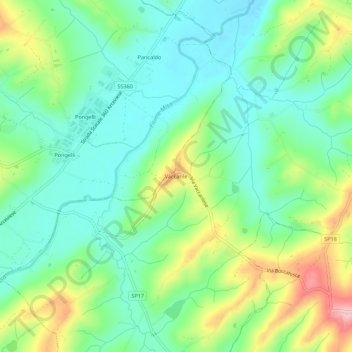
Name: Vaccarile topographic map, elevation, terrain.

Location: Vaccarile, Ostra, Ancona, Marche, Italy (43.57353 13.09105 43.61353 13.13105)

Average elevation: 338 ft

Minimum elevation: 154 ft

Maximum elevation: 722 ft

Gear up for your next adventure:

🪶Survival Guide Book - Expert advice for emergency preparedness
🎁Geography Themed Gifts - Unique gift ideas for map lovers and geography enthusiasts
🏫Relief Map Kits - Hands-on tools for teaching landforms and elevation
🧺Microfiber Travel Towels - Compact and fast-drying towels for trail use
🌡️Portable Weather Meter - Track weather conditions on the trail

As an Amazon Associate, this site earns from qualifying purchases at no extra cost to you.